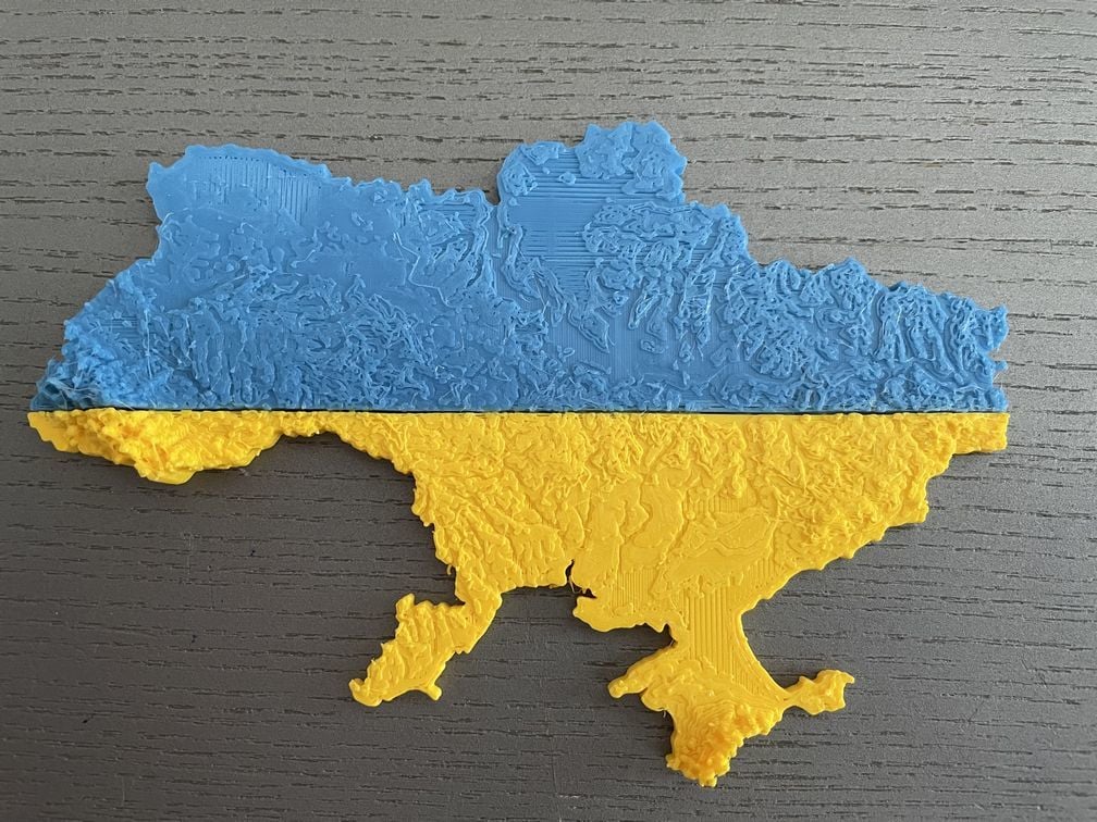
Ukraine topographic map
Remixed by
Boost
15
11
1


Print Profile(0)
Add the first print profile to earn points
Boost
15
11
1
2
26
0
Released
Description
Summary
Topographic map of the Ukraine. Scale of the model is 1:5'000'000 with a vertical exaggeration of 10.
Print was done at 50% xy scale and 250% z scale leading to a overall vertical exaggeration of 50 (Ukraine is really big and flat for most parts, so in order to make the relief pop, one needs to exaggerate altitudes a lot). The model was split in two using Windows 3D Builder app and printed in blue and yellow.
Comment & Rating (1)

Related Models


© 2024 MakerWorld